
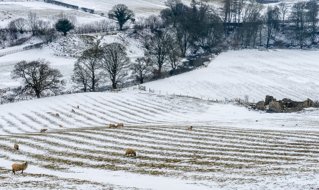
Rig and Furrow
The melting snow reveals the underlying contours of the landscape. The ancient marks of the rig (or ridge) and furrow method of ploughing, used in the middle ages, can be found all over the country.
Elswhere in this photo, the river running through it is the Caldew, which marks the northern edge of the :Lake District National Park at this point.
The tumbledown building on the right was a derelict but intact barn until three or four years ago, when the farmer converted an old mill on his land into a house. He used the slates from the barn roof, and some of the stones from the walls, in the conversion. It is a common practice to reuse materials from unused buildings to build elsewhere.
The steep ridge near the top left-hand corner was the scene of a dispute in the eighteenth century. The ridge marked the boundary between the property of two landowners. One felled two oak trees that stood on his land, and one or both of the trees fell onto the adjacent property, the owner of which stripped off the bark and sold it to the local tannery. Oak bark apparently is rich in tannic acid, and was a valued commodity at that time. I found a record of the resulting court case in Carlisle Castle when I was researching the history of my house and surrounding area.
150
views
- 8
- 2
- Sony ILCE-7M2
- 1/625
- f/9.0
- 66mm
- 400
Comments
Sign in or get an account to comment.


