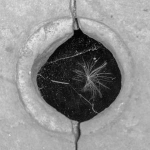
Turnpike Stone
I have begun researching into the history of the area by purchasing some old Ordnance Survey maps and finding two books of the history of the area by a local historian. In the village, at the bottom of our lane, is an old turnpike stone. Interestingly it has a square hole through it, similar to those found on many gateposts. The maps show 'stones' marked in a number of locations, which, together with the books, confirm my growing idea that many of the gateposts were moved to become gateposts, but originally had a different purpose and location. One of these is just a few yards up from our house. It stands at the top of a track down to the site of an old mill (Dawsons Mill) but has no obvious markings or other uses. My intention now is to see how many of the stones I can locate and whether they have markings or obvious uses. This is turning into a bigger project about landscape, its history and the markers that indicate change and development. Having said that, the changes shown on the map have been remarkably few for much of the area for the past 200 years and more.
- 2
- 0
- Apple iPhone 5s
- 1/100
- f/2.2
- 4mm
- 50

Comments
Sign in or get an account to comment.


