
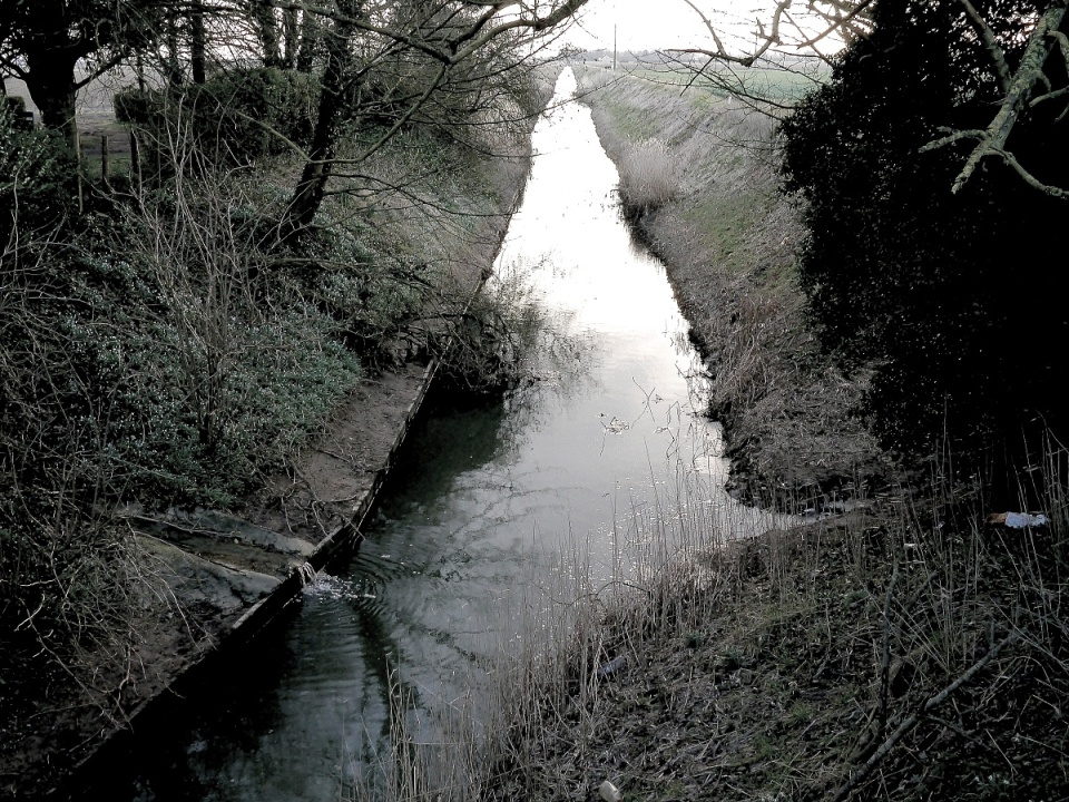
The drain
There are hundreds of miles of these in the fens. Without them we would be awash. I took this shot then coincidentally saw a news item about the problem of flooded fields and future harvests this year. At least the Fens are well drained.
The Fens, also known as the Fenland, are a naturally marshy region in eastern England. Most of the fens were drained several centuries ago, resulting in a flat, damp, low-lying agricultural region. A fen is the local name for an individual area of marshland or former marshland and also designates the type of marsh typical of the area, which has neutral or alkaline water chemistry and relatively large quantities of dissolved minerals, but few other plant nutrients. The Fenland primarily lies around the coast of the Wash; it reaches into two of the nine official regions of England (the East of England and the East Midlands), four ceremonial counties (Lincolnshire, Cambridgeshire, Norfolk and a small area of Suffolk), eleven District Councils and six postcode areas (LN, PE, CB, IP, NR and NG). The whole occupies an area of nearly 1,500 sq mi (3,900 km2). Most of the Fenland lies within a few metres of sea level. As with similar areas in the Netherlands, much of the Fenland originally consisted of fresh- or salt-water wetlands, which have been artificially drained and continue to be protected from floods by drainage banks and pumps. With the support of this drainage system, the Fenland has become a major arable agricultural region in Britain for grains and vegetables. The Fens are particularly fertile, containing around half of the grade 1 agricultural land in England.
Now you know.
Comments
Sign in or get an account to comment.


