
300
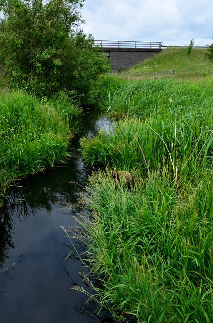
This is a section of Carlinwark Lane. As you can see it's not a bit of paving or tarmac in sight. This is because Carlingwark Lane is not a "lane" at all. It has a rather unusual and unique history. It was, in its day, like the bypass you can see over it.
Indeed it is - or was a sort of canal.
The first Carlingwark canal was dug in 1765 to join Carlingwark Loch near Castle Douglas to the river Dee. It is still visible on current OS maps where it is called Carlingwark Lane despite being a waterway. As a result of this cut the water level of the loch was reduced allowing marl to be dug. Marl was a clay with a high lime content and used at the time as a soil conditioner. The marl was transported out on the canal on barges and distributed to farms lining the river. This practice was abandoned shortly after it started as it became evident that the marl did more harm than good.
Reports refer to a second canal being dug in 1768 to bypass a fast flowing section of the river. This section is still clearly visible just south of Glenlochar barrage and bridge, especially when the river is high. It is believed to have had at least one lock.
When the Hydro Electric Scheme started in the 1930s, there were flood-banks put along parts of the river. There was also a pump house built on Carlingwark Lane. When there is a high flow of water coming down the river to make the electricity the pumps can be put on to control the flow of water from Carlingwark Loch to the River Dee. The fields round about the lane are
mainly meadow-land.
Comments
Sign in or get an account to comment.


