From the top of Cuyamaca Peak
What a day! A hike to the top of Cuyamaca Peak, at 6445 feet, the second highest of the 100 peaks in San Diego County.
An 8.5 mile round trip with some 1800 feet of ascent from a starting altitude of 4600 feet which is higher than the summit of Ben Nevis.
Initially the trail followed a Fire Road before branching off along a series of zig-zags to a col where we picked up a steeply graded paved road to the summit. Part of the zig-zags were rocky and steep, part were through scented pine trees on gentle gradients.
We heard bird calls as we ascended including woodpeckers, Californian scrub jay, spotted towhee, Stellar’s Jay, wrentit and bewick’s wren. Only saw the scrub jay!
The summit was crowned by a vast assemblage of radar and telecommunications kit but there were extensive views to over a 270 degree panorama. This view was looking sort of north east with Cuyamaca Lake to the left and the Salton Sea in the far distance.
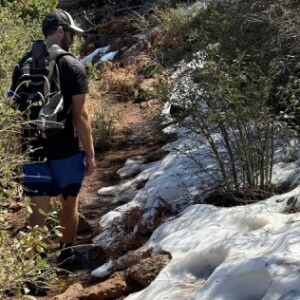
The scenery was spectacular, with far reaching views. And as it was spring, there had been rain and snow (see extra)and there was much green grass around. Julian had loads of daffodils which surprised me!
We took the quick way down following the paved Lookout Road down until we reached the Azalea Springs trail which led us back to the Fire Road and back to the car.
We refuelled at the Julian Brewery with a pint of local nut brown Weasel ale at 5.8% and ribs and brisket before the descent back to sea level.
The day was rounded off with Chris’s neighbour who came over for the evening. We enjoyed a bottle of wine and a Thai takeaway.


Comments
Sign in or get an account to comment.


