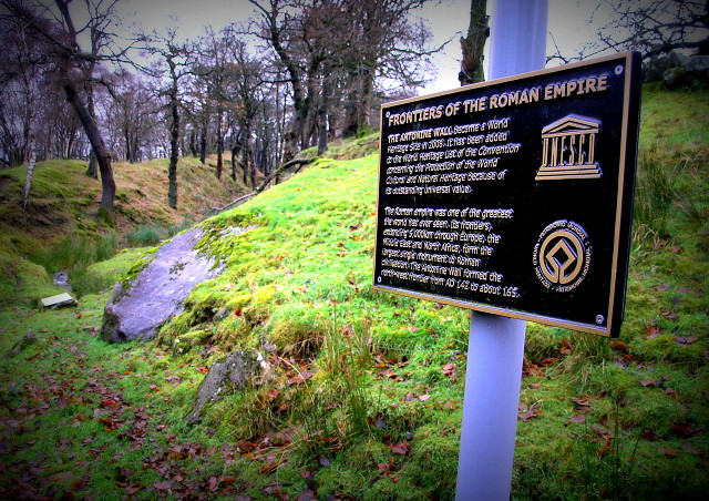
Antonine Wall near Dullatur
Decided to explore a little on the bike this morning, so I took a diversion which on Google Maps looked like a reasonable forest track which ran past Cumbernauld Airport (Yes Cumbernauld has an airport!). It in fact turned out to be very rough and waterlogged for much of the way, however I did stumble across a marked part of the Antonine Wall. (Text on the sign is best read in Larger View)
This was the Northernmost reach of the Roman Empire, but unlike Hadrian's Wall, little of it survived over the years. Perhaps blipping what's left may be a good Blip Project!
Comments
Sign in or get an account to comment.


