
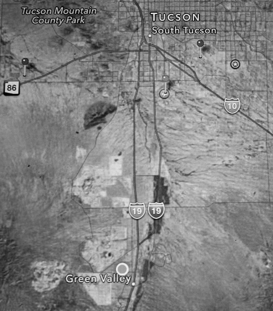
A Satellite View Of Arizona Copper Mines
This is the satellite imagery from the City of Tucson to the town of Green Valley, where I call home.
Those big white, irregular shapes to the west and northwest of Green Valley are open pit copper mines. Most of the time they are good neighbors. On occasion, however, the wind will pick up the "tailings" (crushed waste rock) and cover houses with the grit.
When I take shots of the sunset, I'm usually taking them over the wall of a mine. I will point it out the next time.
Trivia: I-19, which stretches south from South Tucson (where it spawns from I-10) to the Mexican border, is the only section of US Interstate highway marked in the metric system (Km).
Comments
Sign in or get an account to comment.


