Slættaratindur
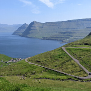
Today we were blessed with more beautiful weather, and spent the morning climbing to the highest point in the Faroe Islands. The walk up Slættaratindur (880m) starts from a car park at 400m, so our drive from Tórshavn ended with a spectacular winding climb up from sea level. The first half of the walk was steep, but that was followed by a rising traverse at a much easier gradient, before a final bit of steep, loose ground and a step up on two big blocks to reach the large, flat summit. There we lingered to take in the fantastic 360° views.
Back down, we continued on the same road as it descended in a series of alpine-like hairpins, and drove to the Faroes' second largest town, Klaksvik. There I found that the Tourist Information café was closed, so we asked a local where we might get food. She told us of a place we'd never have found, and we enjoyed fish and chips surrounded by locals.
With the sun still shining, we drove to Viðareiði, passing so much fantastic rugged island scenery. However, the sky clouded over just as we arrived, so we only had a short walk uphill before exploring the village.
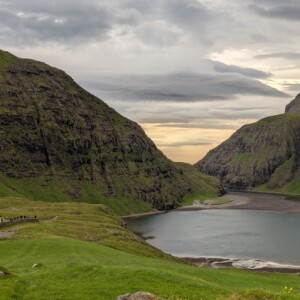
On the drive back to Tórshavn, we stopped off in the hamlet of Saksun - the start of the race that I ran last summer. The old preserved farmhouse and church are pretty, and beautifully sited above a saltwater lagoon. We then went down to the lagoon and followed the short river leading from it to the sea.
One feature of travelling around the Faroe Islands is the tunnels used to go between islands and through the steep hills. Today we took 12, including one of 6.5km (twice). This infrastructure has clearly allowed many villages to stay alive, and prevent a drift of population to the major towns.
See extras from another unforgettable day!


Comments
Sign in or get an account to comment.


