
Clarence River
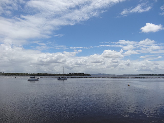
I had two of my lovely cousins and their wives in town and today we took the ferry across the Clarence River to Iluka on the northern side and had a lovely seafood lunch there at the old pub on the water. I didn't take many photos - too busy talking and catching up but I thought I would blip this one anyway as it shows the sheer size and breadth of the river. It is taken from the Iluka side looking upriver and the land towards the back of the photo is part of Freeburn Island, one of the islands in the river, not the other bank, as the river goes around this island and so the far bank is quite a bit behind this island. The posts just sticking out of the water across the middle of the photo are the remnants of the old Middle Wall built in 1894. From approximately 1850 to 1925 shipping was the life line to Sydney and beyond and the only convenient and direct method of transport and 1885 the English consulting engineer, Sir John Coode, was invited to inspect the river entrance and propose a scheme for stabilizing a boat passage through the heads. The construction of the Middle Wall was part of a scheme devised by him to achieve this.
The water is still a bit muddy and we passed a few logs still floating down the river from the flood.
PS probably worth viewing large.
167
views
- 1
- 0
- Sony DSC-HX20V
- f/8.0
- 5mm
- 100
Comments
Sign in or get an account to comment.


