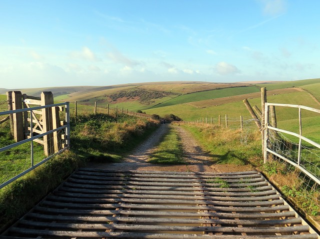
The Cattle Grid
I was up and out at 7.45am this morning as I'd agreed to join Kate, who organises our midweek walking group, in trying out next week's walk. The group meet every other week, and Kate plans a different walk each time, so she studies the Ordnance survey maps and plots a route of approximately 5 miles. She then likes to go and check the route beforehand, so she can see whether it involves walking through fields with cattle, and also so that she knows where we're going on the day.
There were three of us that went with her, together with Louis and Kate's two dogs, and we met up at 8am. We followed the map, although Andy wasn't happy and thought we were going the wrong way, but we carried on for about 3 miles until we reached probably the highest point. Kate thought the sea was to the right of us, but Andy said it was to the left of us - then in the distance we saw someone in long flowing clothes coming towards us, which turned out to be a Nun! We stopped to talk to her, and she said she walks the route quite often so we asked if she'd look at our map and show us where we were. It turned out that we were walking in the right direction, but without knowing it, we'd set off in the opposite direction to what Kate had planned, so we'd walked it in reverse - hence the confusion.
Anyway, we made it back to the cars after walking for 3.5 hours, and on checking the GPS, we'd covered nearly 6 miles The views were stunning and the overall opinion is that it's a good route for next week when it shouldn't take as long as we won't be stopping to check the map. At least it gave me plenty of time for taking photos! If you view it large you can just about see Kate & Andy studying the map as they're walking ;-)
Before heading home we went to a cafe where the others had a cup of tea, but I had a hot chocolate - it was well deserved!
Comments
Sign in or get an account to comment.


