Balerno to Bonaly Walk
As I am feeling much better, but probably not really fit enough to ride a bike. I decide to follow a route I would normally cycle on foot. Of course as soon as I get on the first bus to Slateford, the clouds start coming in on an increasing wind.
Not much better at Slatefore. On the 44 to Balerno now, the clouds look quite dark. At the Balerno terminus, I walk up Mansfield Road and The Common to the car park. I head north east along the north side of Threipmuir reservoir. The main blip is across the reservoir. The slope of Black Hill is on the right, and I am looking towards Bell's Hill. I think the small building is all that remains of a small disused pit. I can feel the wind on my back as I carry on, and light drops of water on the back of my neck. I hope it doesn't rain.
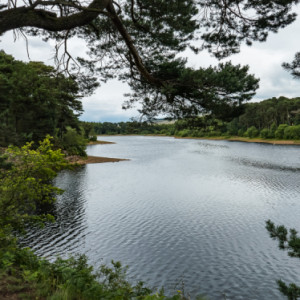
At the end of Threipmuir, the path drops a little, providing a little relief. The path swings right along the weir for the reservoir. The path continues NE from here along Harlaw reservoir. This reservoir is tree lined. The first Extra is along Harlaw viewed through a gap in the trees.
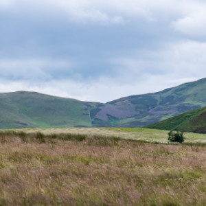
At Harlaw Visitor Centre, I pick up a map, as I left mine at home, I then head SE. I take a wee zigzag set of paths to avoid the Harlaw car park and Harlaw road. The first part is tree lined along Harlaw, then a more open moorland path heading north, then east for about 1km. At this point, I take Extra 3 of Bell's Hill. If I continued E, I would be following Maiden's Cleugh to Glencorse Reservoir and Flotterstone. There aren't many buses from there, so I head north.
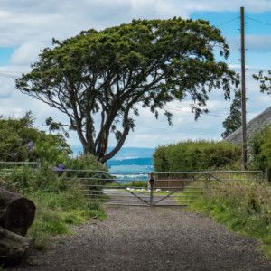
The N path descends over 1.8km to the junction of Harlaw Road and Kirkgate. Halfway down the path, if I was adventurous, I could follow the pylons NE cross country and get to Bonaly quicker. The path is rocky, and not easy to walk on, but easier than the unknown grass land, as well as the Kinleith Burn to cross. So continue down. At the end of the path, I take Extra 3. An interesting tree, a slightly bent gate and a wee cottage. What you can't see is the big drop down to civilisation.
On the junction, I walk east along to Easter Kinleith, where I pick up my last path. This initially heads south, before curving east along a track to Clubbiedean Reservoir. The path becomes a narrow tarmac road. This reservoir is popular for fishing, Extra 4. This was taken at the west end of the reservoir. What you can't see is the underwater barrier to stop the boats drifting east towards the dam. I walk NE along the north side of the reservoir.
The east end of the Clubbiedean drops quite significantly. I enter a narrow gorge. I can hear, but not see the waterfalls to my right. I reach my final reservoir, Torduff. The path is on the north side. About 3/4 along, I take Extra 5 looking NE. Arthur's Seat seems to sit on top of the dam at the NE edge of Torduff.
The road descends here. The final descent. In the damp, the pine needles from the overhanging trees make cycling down the road interesting. at least I am walking. Where the road levels out a bit, Bonaly Tower peeps out of the surrounding trees. Extra 6. You wouldn't think I am near Edinburgh. Quite Gothic. The road is named now. I am walking on Torduff Road, which brings to Bonaly. I walk through Bonaly to Dreghorn Rd.
I am in luck. there is a bus there, and number 16, which will take me near home. Just as I get to the bus, the sun has come out as well.
All in, a total of 13.5 km of walking from No 44 bus to No 16 bus. I snack on a snickers.


Comments
Sign in or get an account to comment.


